The Dalton Highway
The Dalton Highway is an isolated and mostly unpaved road that begins outside of Fairbanks, Alaska and ends 414 miles (666 km) later just shy of the Arctic Ocean in Deadhorse, AK. It’s the farthest north you can drive on a public road on the North American Continent. With one section being 240 miles between gas stations, it includes the longest stretch of road in America without services. The road follows the Alaska Oil Pipeline, takes you across the Arctic Circle, and the continental divide at Atigun Pass which is the highest elevation year-round road you can drive in Alaska.

You’ll see plenty of wildlife, including the possibility of black, brown, and polar bears–the bear trifecta. In the winter months the northern lights will be on display, and in the summer you’ll see the midnight sun. It was also featured on the early seasons of “Ice Road Truckers” on The Discovery Channel. Need any more reasons to drive this road?
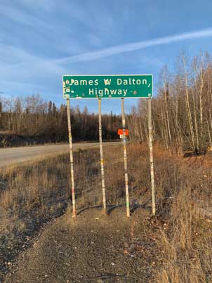
Officially labeled on maps as Alaska Route 11, the road began as a supply route during the construction of the Alaska Oil Pipeline in 1974, and now continues to serve as the main artery for transporting equipment and supplies up to the oil fields of Prudhoe Bay and the several thousand workers based there. Originally called “The North Slope Haul Road,” it wasn’t opened to the public until 1994. It was then given the name, “The James Dalton Highway.” James W. Dalton was an Alaskan engineer and an expert on the untamed North Slope of Alaska. After WWII, he oversaw the construction of the Distant Early Warning Line, a system of radar stations running across the top of North America designed to detect inbound Soviet Bombers during the Cold War. He later served as a consultant during the years of oil exploration in the remote region of Prudhoe Bay. The road serves as a memorial to this great Alaskan pioneer.
-
 Accidents do happen on the Dalton...
 -

Some websites and YouTube videos have labeled the Dalton the “Most dangerous road in America.” Is it really that bad? No, not at all. Although it is indeed a mostly dirt road located in the middle of nowhere, the reality is that the Dalton is a well maintained and well used road. It’s plenty wide for traffic going in each direction, plus there is a soft shoulder along most of it which allows vehicles to safely pull over if necessary. Since the road is mostly dirt and gravel the chance of a flat tire or cracked windshield is high, but if you drive at a reasonable and safe pace you’ll seldom be inconvenienced by such setbacks.
I rarely went more than 15 minutes without seeing another vehicle, so there are other people around if you get into real trouble. The trucks are moving at a pretty good clip, but as long as you slow down and give them some space you’ll be fine. I could argue that a busy interstate is far more dangerous than going 35 mph on a gravel road you share with the occasional heavy truck. As with any road, the overall safety depends a lot on the weather. I wouldn’t travel on many roads in a snowstorm and the Dalton is no different. The bottom line is, you should travel prepared with spare tires, fluids, and tools that you know how to use. Check the weather, use some common sense, and drive at a safe speed.
Trip Overview
The trip up the Dalton is divided into two main sections. The southern half starts just north of Fairbanks and takes you across the Arctic Circle to Coldfoot Camp, where you’ll find a full service truck stop, accommodations, a visitors center (summer months), and various tour operators. Plenty of folks will call Coldfoot their destination and head back from there which is definitely a reasonable option. If you choose to continue, the next 240 miles north will take you across the scenic Brooks Range, Atigun Pass, and then a slow decent across the vast tundra of the North Slope into Deadhorse. Other than being a beautiful scenic drive, and the ability to say “been there,” there is no major payoff for reaching the top of the road at Deadhorse. The “town” is all industrial, and other than a general store there’s nothing to really do or see there. The public road ends and becomes private access the rest of the way to Prudhoe Bay (and the Arctic Ocean). In the summer months you can take an organized tour into the security zone and frolic on the gravel beach of the ocean for a few minutes, but you won’t be setting up a picnic or beach volleyball net. I of course recommend going the whole way, but don’t expect an Atlantis Resort up there. For this adventure it’s the journey to get there, not necessarily the destination that awaits you.
If you want to travel up the Dalton Highway, you have a few choices. The easiest and arguably safest is to take an organized tour with one of several companies that run trips up the highway. You can expect to travel in a standard 10-passenger van, which is probably not the most comfortable ride, but you’ll have an experienced driver and tour guide who can handle any issues that pop up. Another benefit of a tour operator is that you have the option of driving up and flying back. Both Coldfoot and Deadhorse have airports, and so you can drive the Dalton one way and then take a plane ride the other.
You can take your own car if you have good tires, but expect a few nicks and scratches from the spray of rocks that follow behind every truck like a group of screaming teenagers chasing a pop star’s tour bus. The other option is a rental car; however, the major companies specifically prohibit the use of their vehicles on the Dalton. There are several companies that rent specially equipped vehicles for use on gravel roads, but the cost can be high, plus it’s a two-way drive. There is no option of dropping off the rental in Deadhorse and flying home. If you drive a rental car up the road, you have to also turn around and drive it back. The only way around this would be to get a little creative and book the rental car with a group of friends, some of whom fly up to Deadhorse and you swap out there.
When To Go
Since the road is maintained all year round, technically you can make the trip any time of year. Whichever month you choose, there will be pros and cons. In the winter it’s dark 24 hours a day (once you pass the Arctic Circle) so you won’t get to experience any of the fantastic scenery. The road over the mountain is plowed but they do close it periodically for avalanche control (they blast the mount side with canons). Therefore, I wouldn’t recommend a winter trip up there. In spring you can expect the roads to be a bit muddy with the snow melt, but you’ll get a colorful display of wildflowers. In the summer months you’ll get long days of sunshine and pleasant temperatures, but you’ll be eaten alive by mosquitos. At the Yukon Camp I smirked at the shelves full of mosquito repellant and windshield washing fluid next to the register. I suspect those are their best sellers.


I did my trip via rental car in early October. Temperatures at night were just below freezing so the mosquitos had all vanished for the year. The days were cool but comfortable, and the roads were dry. It was almost too dry, since on day three a sharp rock found it quite easy to go into my tire rather than down into the road. If there was a color theme for my trip, it was brown. October was too late for enjoying the fall colors so I could only just make out the remains of what were once brilliant reds and yellows. I also missed out on the oil field tour and the opportunity to dunk my toes in the Arctic Ocean, as the tour operator shuts that down for the winter season in mid-September. Same goes for the visitor centers along the way; they also close for the year in mid-September. I think a lot of the wildlife had packed up and moved elsewhere for the winter, as I didn’t see much. I came across a herd of musk ox, a red fox, and lots of birds but that was about it. Of course I may have passed a Bigfoot riding a unicorn but not seen them because most of the time I was laser focused on navigating the minefield of pot holes.
My recommendation for the perfect time of year to go would be the first half of September. All of the tour operators are still running, the fall colors should be at their maximum, there is a decent chance of seeing the northern lights, and you might be lucky enough to not experience the mosquito invasion.
Renting a Car
If you decide to go with a rental car, there are a handful of companies that allow their vehicles to be taken on the Dalton:
Arctic Outfitters
Go North Rentals
Alaska Auto Rentals
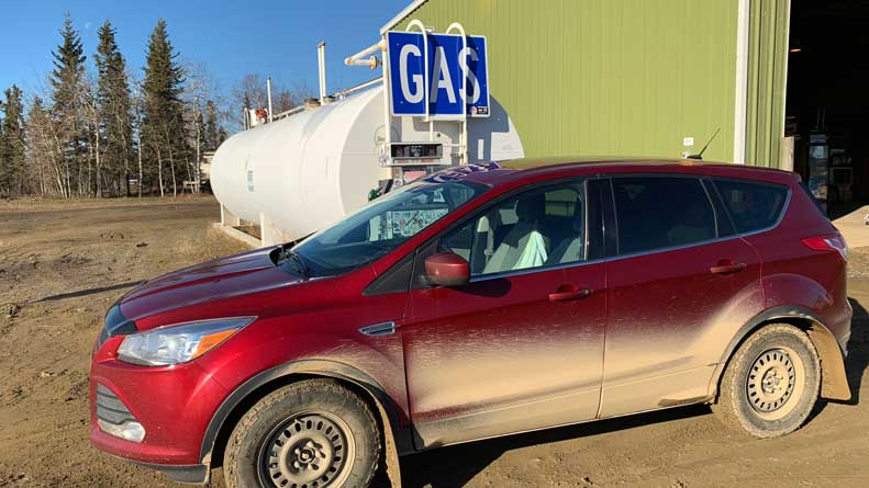
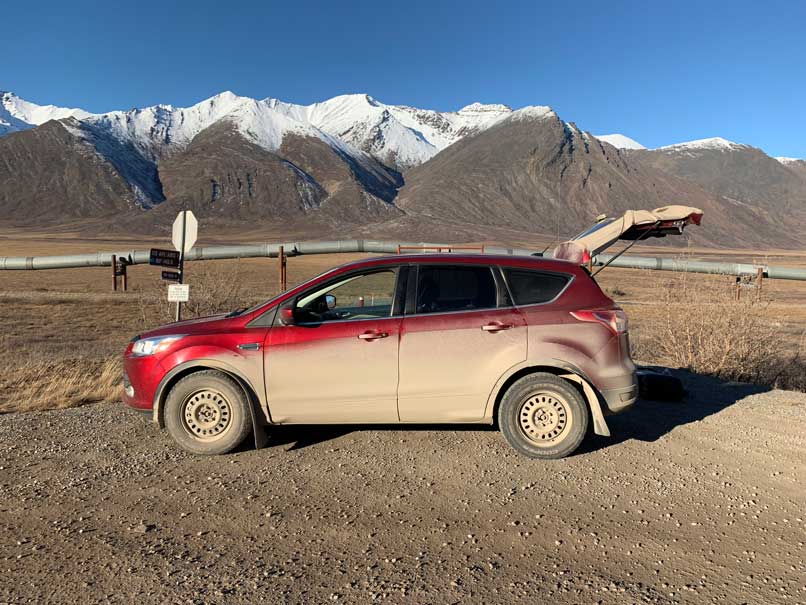
I went with Arctic Outfitters. They have only one type of car to choose from: Ford Escape. They come with all terrain tires, a hard-wired CB radio, two spare tires (one full size and one donut), a tool kit, and in the winter months a sleeping bag and satellite phone (for emergencies). They rent by the day, so that means if you pick up the car at 5pm you pay for the whole day. The flip side is that you can return the car at 11pm on the last day and jump on a late night/early morning flight out of Fairbanks, which is exactly what I did (1:30am flight to Seattle). Their rate varies depending on the time of year, but expect to pay at least $250-$350 per day with the taxes added in. They also add a charge if you go over 250 miles per day on average. I did a five-day rental and from the Fairbanks airport up to Deadhorse and back I logged 1,043 miles. So, if you do a four-day rental or less and drive the whole road, expect an additional mileage charge. Officially it seems that Arctic Outfitters do not allow their rental cars north of The Brooks Range after mid September (which means no Deadhorse), but they told me that was a new rule and didn’t seem to mind me doing it (I went in early October), so it may be negotiable.
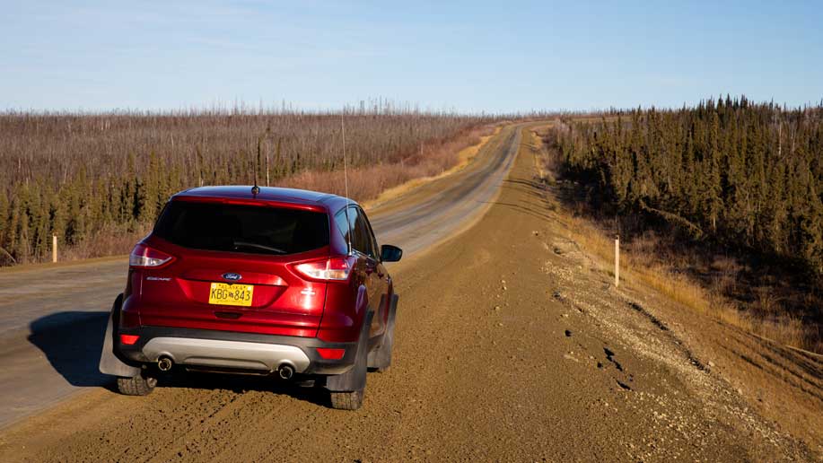
My nice and clean rental car at the begining of the trip
4 days later, my car was covered in dirt, had a cracked windshield, and was riding on the spare tire.
When I first drove the Ford Escape off the lot it felt pretty small to me. I was wishing I had gotten a full sized SUV with a bit more space, height, and beefier suspension. If I did the trip over again I might research some of the other companies a bit more, but in the end the Escape did the job and the customer service at Arctic Outfitters was great. Another convenience with using them is that the same company owns the Coldfoot Camp truck stop, so they also took care of booking and billing the accommodations there. I had to make use of the repair shop at Coldfoot to fix a flat tire and since it’s the same company there was no additional charge. More on that part of the story later.
Another nice thing about Arctic Outfitters was that there was no up-sell for additional insurance. They ran through some general rules and sent me out the door. Before I left I specifically asked about chipped windshields and I was told there would be no additional charge for any damage like that. And sure enough, I returned that car beaten and barely recognizable with a nice long crack in the windshield, several chips, the whole thing covered in dirt, and a punctured tire in the back. I tossed the keys in the drop box, snuck off into the night like I was breaking out of prison, and never heard another word about it. Granted they must build some repair costs into their daily rental fee, but I appreciated not having a high pressure insurance sales pitch along with the awkward return inspection and the “that was already there” argument. So all things considered, I had a good experience with Arctic Outfitters.
Fairbanks to Coldfoot
I picked up my car in the afternoon and then stocked up on supplies and snacks in Fairbanks with the intention of getting an early start the next day. Everything up north is more expensive, so it’s best to get a few things in Fairbanks. On a whim, I grabbed a gallon of windshield fluid which turned out to be a good idea. If I didn’t constantly keep the rear window clean it would quickly cake over with dirt and I wouldn’t have been able to see the trucks sneaking up on me.
The first leg of the journey is the 80 miles from Fairbanks to the beginning of the Dalton Highway, which is just past the town of Livengood. You’ll get your first glance of the pipeline shortly after you leave Fairbanks where the road narrows to one lane each way. Look to your right and you’ll see a pull off for your first photo-op of the trip! If you want to fill up the gas tank on your way out of town, you’ll pass by a gas station and general store at the town of Fox, and then a few miles later a truck stop called the Hilltop.
For the next 70 miles or so you’ll be traveling on the Elliot Highway (AK 2), which is paved but deteriorates as you get closer to Livengood. The road gets wavy and full of potholes, almost like it is offering you a preview of what’s to come and asking, “Are you sure about this bud?”
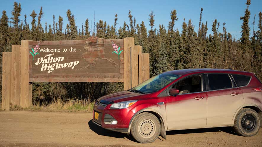
Just past the town of Livengood the road forks. To the right is the Dalton Highway, marked by a tall green sign announcing the start of the road. If you’re following a guidebook with mile markers, zero your trip computer here. Less than a mile up the road, at the top of the first hill on the right, is the wooden “Welcome to the Dalton Highway” sign that is a must have photo.
The Dalton greets you with packed dirt and gravel right away, and then teases you with short stretches of pavement. In many ways the paved sections are worse to maneuver. The potholes are more severe and the transition from pavement to dirt is often jarring. You’ll learn pretty quickly what items in your car are not secure. The posted speed limit on the Dalton is 50 mph, but I spend most of my time in the 30s. Any faster than that and you’ll not have enough time to see the oncoming potholes and make the split second decision of left, right, straddle, or clench and take it.
The sign marking the beginning of the Dalton Highway, just past Livengood
-
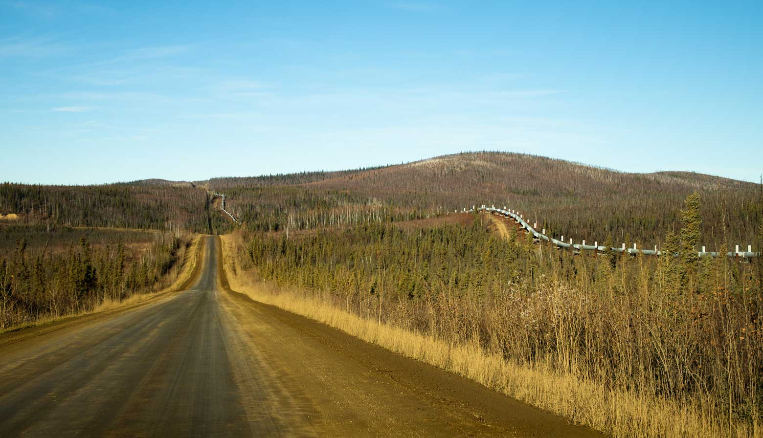 The peipleline will follow the road North
 -
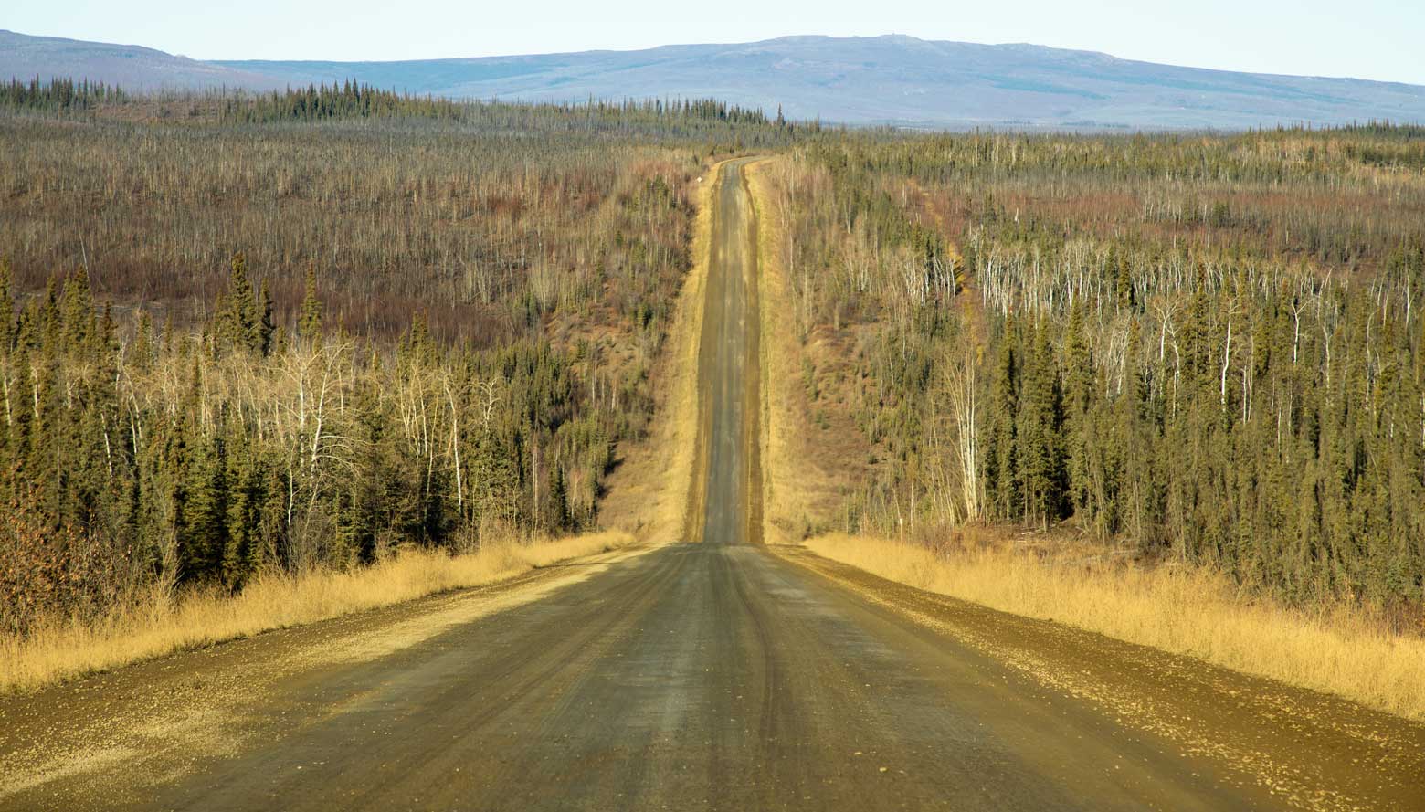 The road is mostly hard-packed dirt
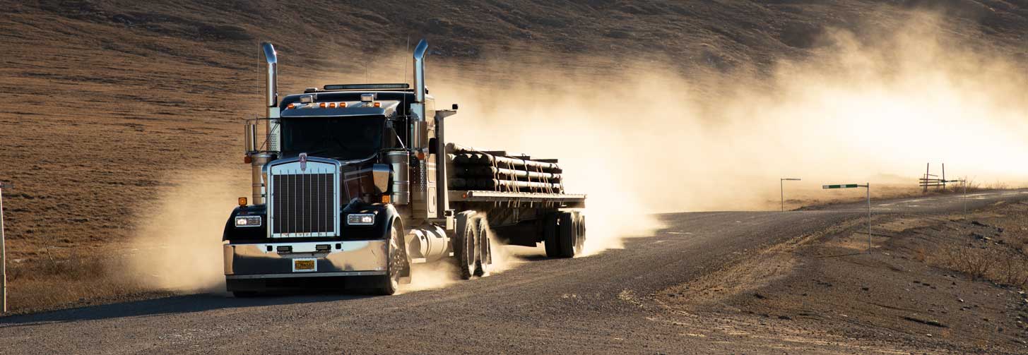
Keep in mind that most of the vehicles you'll see on the road are out there working. You’ll encounter plenty of heavy 18-wheelers moving all sorts of alien looking equipment, oil company pick-ups, and the occasional road construction crew. It’s best to take the mindset that the road belongs to them and to give them the right of way and extra room whenever possible. Don’t stop for a photo in the middle of the road. Pull over and allow other vehicles to pass when they come up behind you (they will definitely be driving faster than you). If you have a CB radio, listen to channel 19. All the workers use that channel to chit chat and pass on road condition reports. I used it only twice, and both times was to ask a slow moving construction vehicle in front me if it was safe to pass; so it does come in handy. If you have any traffic coming at you, it’s best to slow down and roll your windows up since you’re about to get showered with rocks and dust.
The first stretch of the Dalton takes you across rolling hills and dense forests. Keep an eye out for moose and bears! You’ll catch a glimpse of the pipeline every now and then, but don’t try too hard for a photo because eventually the road and the pipeline come together for long stretches. Every 15 miles or so you’ll see a blue sign that informs you of a spot to pull off the road. Some are good photo-ops and include interpretive displays, some have outhouses, some have picnic tables, and some are nothing more than a gravel lot.
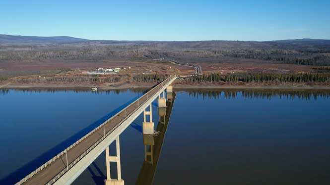
The Yukon River bridge
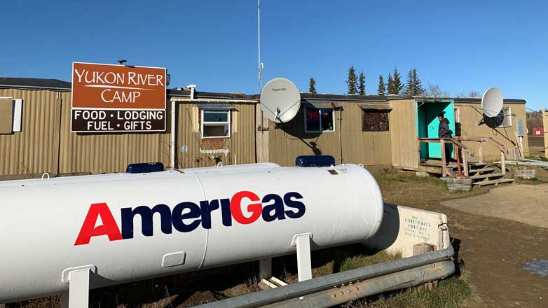
Yukon River Camp cafe
The Yukon River gas pump
Your first major point of interest will be the Yukon River Bridge. On the north side is the Yukon River Camp, which is a good place to fill up on gas and grab lunch at the cafe. For the gas station, and all stations along the road, the pump is located next to a giant above ground tank. You first need to give your credit card to the cafe and then after filling up you have to take a picture of the final pump numbers to provide to the cashier.
Before continuing north, be sure to check out the interpretive displays on the opposite side of the road from the camp. Next up is the Arctic Circle marker, which is another must have photo-op and a good spot to take a break if you brought a picnic lunch.
-
 Coldfoot Camp Truck Stop
 -
 Coldfoot Camp main accommodations
 -
The scenery gradually changes to more substantial looking hills, and you’ll pass a few scenic viewpoints at the crests. Just when you are starting to think you can’t take another pothole, the road turns to pavement for the rest of the trip into Coldfoot. The Coldfoot Camp Truck Stop is an oasis on your trip up the Dalton. The folks are friendly, the food is good, and the accommodations are basic but comfortable. I spent a night there on the way up and again on the way back and really enjoyed talking to all the other travelers stopping there for the night. The northern lights were visible even with the lights of the truck stop, and they also offered midnight tours to the town of Wiseman for some better photo opportunities.
There is Wi-Fi at Coldfoot for an additional charge (either daily or by the hour); however, it was pretty intermittent. I was told if too many people at the camp are trying to use it at the same time the service gets choked up and not everyone can log on at once. I had my best luck late at night and early morning.
Coldfoot to Deadhorse
The north section of the Dalton is definitely the most exciting part of the drive. First, as you leave Coldfoot you’ll see a sign that says “next services: 240 miles.” I knew that my Ford Escape would get me at least 300 miles on a tank, but you can’t help but be a little nervous. I was “that guy” at the gas pump, ever so slowly squeezing in a few more drops of fuel until even the tube from the gas cap to the tank was full.
When you make that turn onto the Dalton from the Coldfoot Camp, you’ll have the best road conditions of the trip. About 50 miles of almost flawless pavement that will make you forget the fact that you are in the middle of nowhere. Even when the pavement ends, the first stretch of dirt is gloriously smooth.
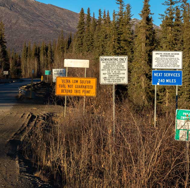
At 240 miles, this section of road is the longest stretch of road without services in America
The scenery really steps up its game at this point as well. The mountains on either side of the valley start to grow higher and the first signs of snow will appear. The pipeline will stick close to the road and gives you constant assurance that you are heading the right direction. You’ll zigzag across mountain streams and have a good opportunity to catch sight of wildlife on the banks.
Your first big climb up the Brooks Range comes just after mile marker 235 which is referred to as “The Farthest North Spruce.” It’s a good spot for a quick break before you head up above the tree line. After the first climb you’ll level out onto the Chandler Shelf, which is a very scenic plateau on top of the range. The road is fairly decent, but it gets a bit rocky. You’ll pass by an airstrip and an outpost that is manned year round by crews charged with keeping the road open. There are no public services here, but if you get into real trouble you should be able to reach the station on channel 9 of your CB radio.

The Chandalar Shelf, leading to Atigun Pass
The next climb takes you to the top of Atigun Pass, which at 4,739 feet is the highest point on the road, and also the continental divide. After one short but steep set of switchbacks you’ll be on a gradual downhill of the North Slope all the way to Deadhorse. This was one of my favorite sections of the drive as there are no trees this far north and you could see clear to the horizon out in front of you. The mountain range gives way to the open tundra which is spotted with crystal blue lakes. If you want to get a good photo of the pipeline, this is probably your best opportunity as the pipeline is right next to the road. The lack of trees and backdrop of the mountain range will make for a nice addition to the trip album.
This also happens to be the spot where I got my flat tire, which was on the way back south after leaving Deadhorse on day three of the trip. I was driving along admiring the view when I got a “ding ding ding” from the Ford Escape. Triple chimes are never good, and a look down at the dash told me it was a “tire pressure low” warning. There happened to be an access road to the pipeline just ahead so I pulled over to investigate. As soon as I opened my car door I hear the telltale hiss of air escaping from my left rear tire. Great. At first I was very disappointed with myself as I thought I had been driving quite well and missing most of the potholes and larger rocks, but the road was very dry and thus very firm, so I must have hit one small rock just right for a puncture in my tire. I knew I had two spares, one full size and one donut, but I still had a long drive back over Atigun to get to Coldfoot. I was hoping it wasn’t the beginning of a string of bad luck.
A scenic spot for a flat tire
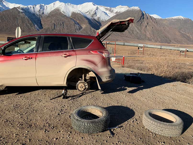
Well there's your problem!
I pulled out of my kit from the back and laid it all out behind the Escape. The rental came with a tool box where I found the jack, a wooden block to place it on, and a nice sized tire iron. I was on a slight incline but it was a pretty decent spot to change a tire, and at least the weather was good. It had probably been a good 20 years since I had to change a tire, and that was in the relative safety of a paved and level parking lot.
I struggled a bit getting the wheel off; it was hanging on pretty tight, but after a few grunts and swear words it broke loose. The whole thing took me about 30 minutes, and during that time 3 or 4 other vehicles came by. One slowed down enough to make eye contact and I gave him a thumbs up, but the others just continued on without an offer of help. I was a bit surprised the other vehicles didn’t at least stop to see if I had it under control, but it might have been a different story in bad weather, or maybe they could just see I had it handled. Anyway, I was back on the road but was definitely driving a bit slower and wincing at every bump and rock I rolled over.
When I got back to Coldfoot that night I went over to the shop and found a guy named John who patched up my tire. Took about 20 minutes during which he told me “it happens all the time on that road.” I asked him how much I owed, and he said not to worry about it as the whole truck stop is owned by the same company that runs Arctic Outfitters, my rental car company. Perfect!
So back to the story of the trip into Deadhorse. Once you get out of the mountain valley you’ll be in the wide open tundra of the North Slope. When I was there the ground was frozen, but in the summer months it’s more like a swamp–paradise for mosquitos. You’ll eventually hook up with the Sag River which you’ll follow all the way to Deadhorse. I’m told there’s good fishing if you bring any gear with you, and also there’s a pretty good chance you’ll see wildlife near the river. This is where I caught my glimpses of a herd of musk ox as well as a red fox bouncing around in the shrubs hunting for dinner.
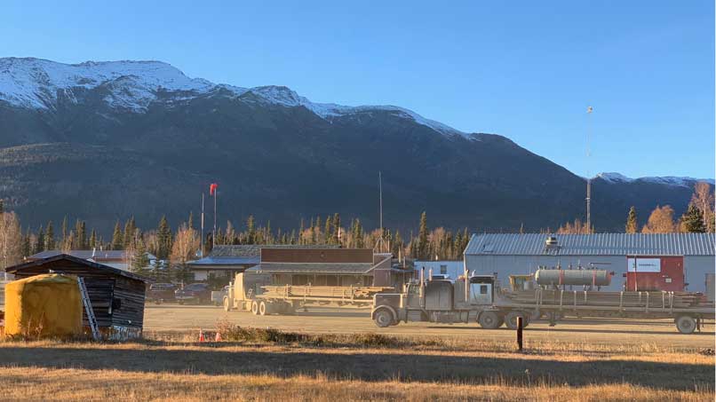
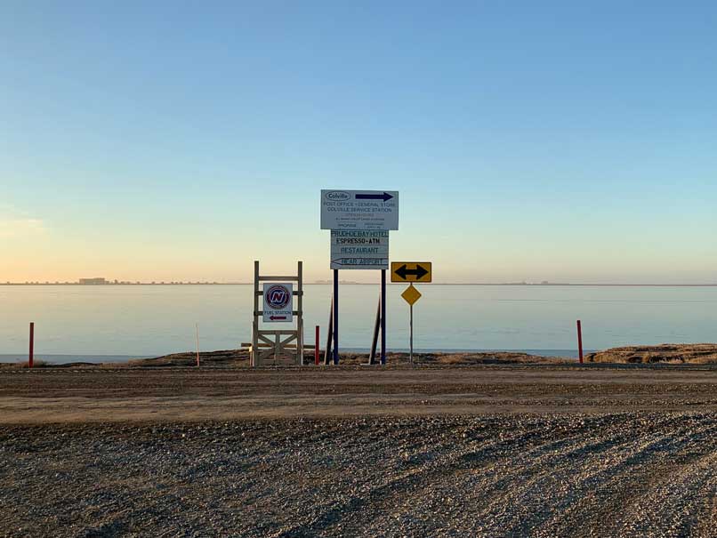
The road is built up about 10 feet off the tundra and there’s a fairly steep drop off on either side. This road can be foggy so be careful in bad weather. The final stretch into Deadhorse seems to go on forever, but eventually the cluster of industrial equipment and buildings will come into view on the horizon, as well as the smell of the ocean. The road comes to a “T” at a lake in the center of town. To the left you’ll find the Prudhoe Bay Hotel and one of two gas stations, and to the right you’ll find the Brooks Camp Hotel and general store, the Arctic Oilfield Hotel, and the second gas station. The general store is the unofficial end of the Dalton Highway road trip and makes for a good photo op in front of the front door sign covered in stickers and signatures. The store has a decent stock of supplies plus a gift shop to grab your trophy of choice to commemorate the journey or to mail a postcard.
-
 The end of the Dalton HIghway in Deadhorse, Alaska
 -
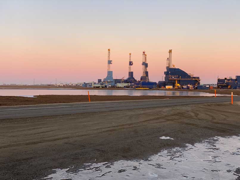 The industrial town of Deadhorse, Alaska
 -
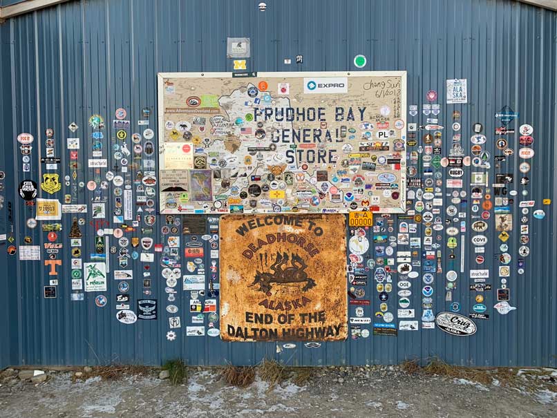 The unofficial end of the Dalton is the Prudhoe Bay general store
 -
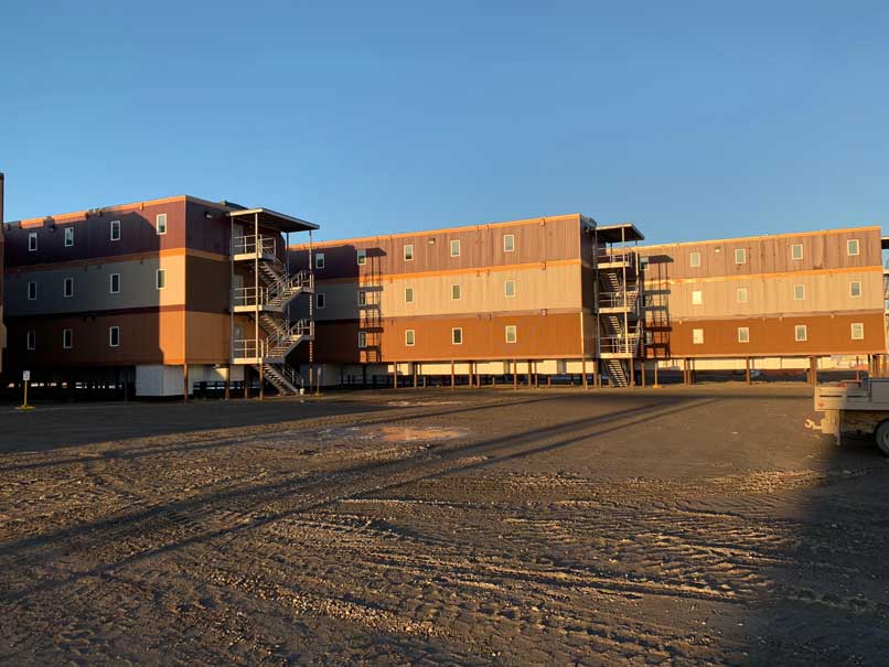 The Arctic Oilfield Hotel
 -
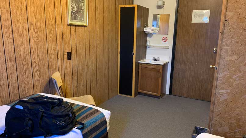
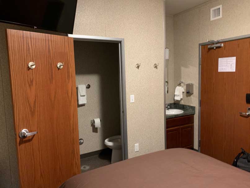 Small but comfortable and clean room at the Arctic Oilfield Hotel. Plus good WiFi and TV!
 -
 I didn't see any other tourists up in Deadhorse
There’s not really anything else in the town of Deadhorse to see or do. There’s no visitor center, restaurants, or pubs and nobody lives there. There is an airport that is served by Alaska Airlines but there are no taxis or rental car companies there. However it is kind of neat to just drive around and look at the town. All of the lots are owned by companies who support the oil drilling at Prudhoe Bay. It’s mostly heavy equipment storage yards, oil company offices, and warehouses. If you keep trying to drive north you’ll come to a security checkpoint and you’ll have no luck continuing on up the road to the ocean. The only way to go the final six miles is to buy a ticket with the tour company which runs twice daily trips during the summer months. They take you across the oil fields and to the ocean. It’s a bit pricey, but well worth it to stand at the top of the continent.
There are a few hotels in town, most of which are occupied by oil workers. I stayed at the Arctic Oilfield Hotel, which I found out the local workers refer to as “The AOH.” I mainly picked that hotel because it was available to book on Expedia and because it looked fairly new. It was actually quite comfortable. It had small but adequate rooms with a TV, good Wi-Fi, great cafeteria (included in the room price), and friendly staff. Get a good night’s sleep, because in the morning you turn around and drive The Dalton all over again!
Additional Tips
I was surprised at how much time I spent in the car. I figured it’s “only” 250 miles a day but it’s fairly slow going at some points. I did stop at pretty much anything that was even a remote possibility for a good photo, and I was delayed slightly by road construction in a few spots. In all I spent about 10 hours between hotels for those 250 miles each day. It was a bit quicker heading southbound since I didn’t stop at all the same scenic views. Four days is perfect for this road trip, but if you’re planning the minimum time necessary, I’d say it’s three days. The first day heading to Coldfoot, then to Deadhorse on day two, and one long push back to Fairbanks on day three, only stopping for gas.
I rented my own satellite phone from GlobalCom. I researched a few different companies and these guys seemed to have the best balance of price and convenience. You only pay for the days the phone is in your possession, while other companies charge you for days the phone is in transit via FedEx. I also added on a package of 40 minutes and called some family members at the Arctic Circle and the continental divide just to say “hey guess where I am!” It turned out that my rental car company also provided a sat phone for emergencies, but for some reason I wasn’t aware of that ahead of time. Or maybe they only provided me the phone because I was going all the way up to Deadhorse in what was technically the off season for tourists.
All in all this was a fantastic road trip. The scenery was spectacular and varied greatly throughout the drive. Even though it’s just a road, I felt a sense of accomplishment by completing the trip, as only a relatively small number of people make the trip all the way up to the top. I did get really lucky with the weather (not a single cloud all four days), plus I never had to swat away a mosquito. The roads were in good shape and not too busy. My flat tire was annoying and a bit concerning at the time but definitely added to the overall sense of adventure. Pick the time of year that best suits your preferences, travel prepared for some car trouble, drive safely, and you’ll have a great time as well!
Resources and Links
FocusOnAdventure
JM